blah blah blah
Mt. Hight
Length: 8.8 miles out-and-backDifficulty (click for info): Very Hard
Elevation Gain: 3200 feet
Rating (click for info): 9/10
Elevation: 4675'
Prominence: 125'
Driving Directions:
Trailhead and parking area are on Rt. 16 in Green's Grant, NH (summit is in Bean's Purchase). The parking area is on the east side of the road, 6.8 miles south of Rt. 16's eastern junction with Rt. 2 and 12.8 miles north of its northern junction with Rt. 16A. Click here for a Google map.
About the Hike:
Although just a sub-peak of Carter Dome, Mt. Hight provides hikers with the finest views in the Carter Range. It is also home to a small alpine zone, something Carter Dome doesn't have. Most hikers climbing Mt. Hight are also visiting Carter Dome, but if you're not working on the 4000-footers, it is a great hike by itself. If you are climbing the 4000-footers, you can include Mt. Hight in the Carter Dome Loop, a great loop hike which also visits Carter Notch and South Carter.
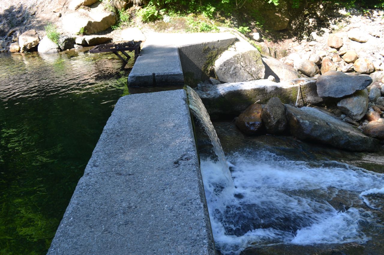
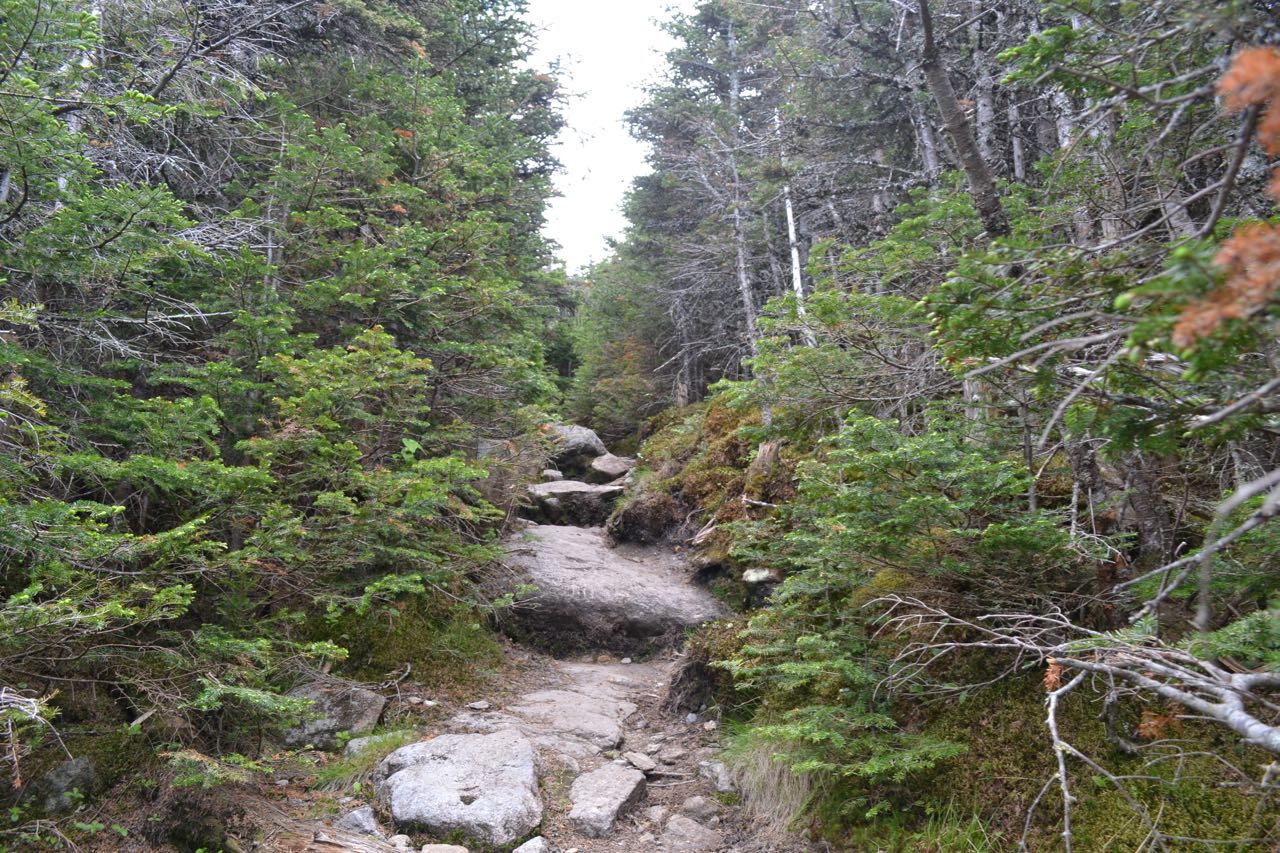
Leave the parking area on Nineteen-Mile Brook Trail and immediately begin following the brook on a wide dirt path, climbing gradually. After a short stretch close to the brook, the trail begins to pull away. After crossing a bridge over a tributary, it soon heads back and continues easily along the bank, passing an open area above a small waterslide. It again follows the brook closely except through a relocation which heads up and over a small knoll to bypass storm damage. Several more cascades are passed in this section. At just over one mile from the parking area, the trail crosses another tributary on a larger, recently built bridge, then leads back to Nineteen-Mile Brook, where it passes a cement dam. From here, it continues along the brook, but at a greater distance, gradually splitting off. In 0.7 miles from the dam, turn left onto Carter Dome Trail. This trail continues at easy grades along a tributary brook, passing through a few grassy sections before crossing the brook half a mile from the junction. In another 0.3 miles, it crosses again near a small cascade and pool. On the other side, it begins to steepen as it prepares for a long, switchbacking climb. You can hear the brook for quite a distance before it finally fades away. Grades remain moderate as the trail winds back and forth up the mountainside for a mile. After a sharp right turn, the trail heads straight uphill, soon reaching a trail junction just above Zeta Pass, the col between Mt. Hight and South Carter Mountain. Turn right onto the combined Carter Dome Trail/Carter-Moriah Trail. In 0.2 miles, turn left onto Carter-Moriah Trail as Carter Dome Trail continues ahead. The trail continues climbing moderately, then begins a short, steep ascent. Near the end, the trail scrambles up alongside open rock, then emerges in the alpine zone and leads easily to the summit of Mt. Hight, 0.4 miles from Carter Dome Trail.
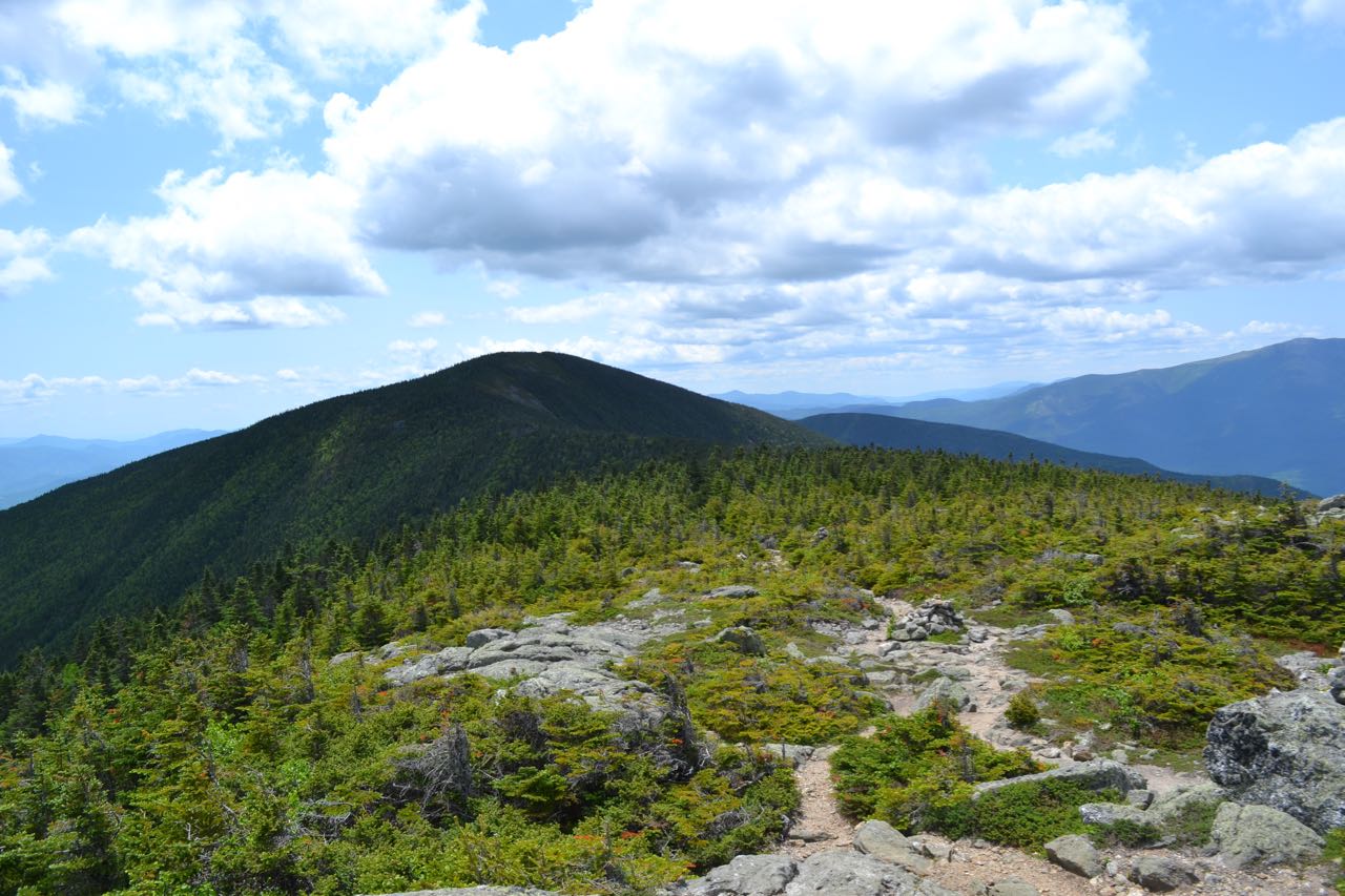
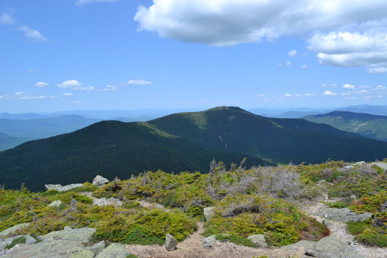
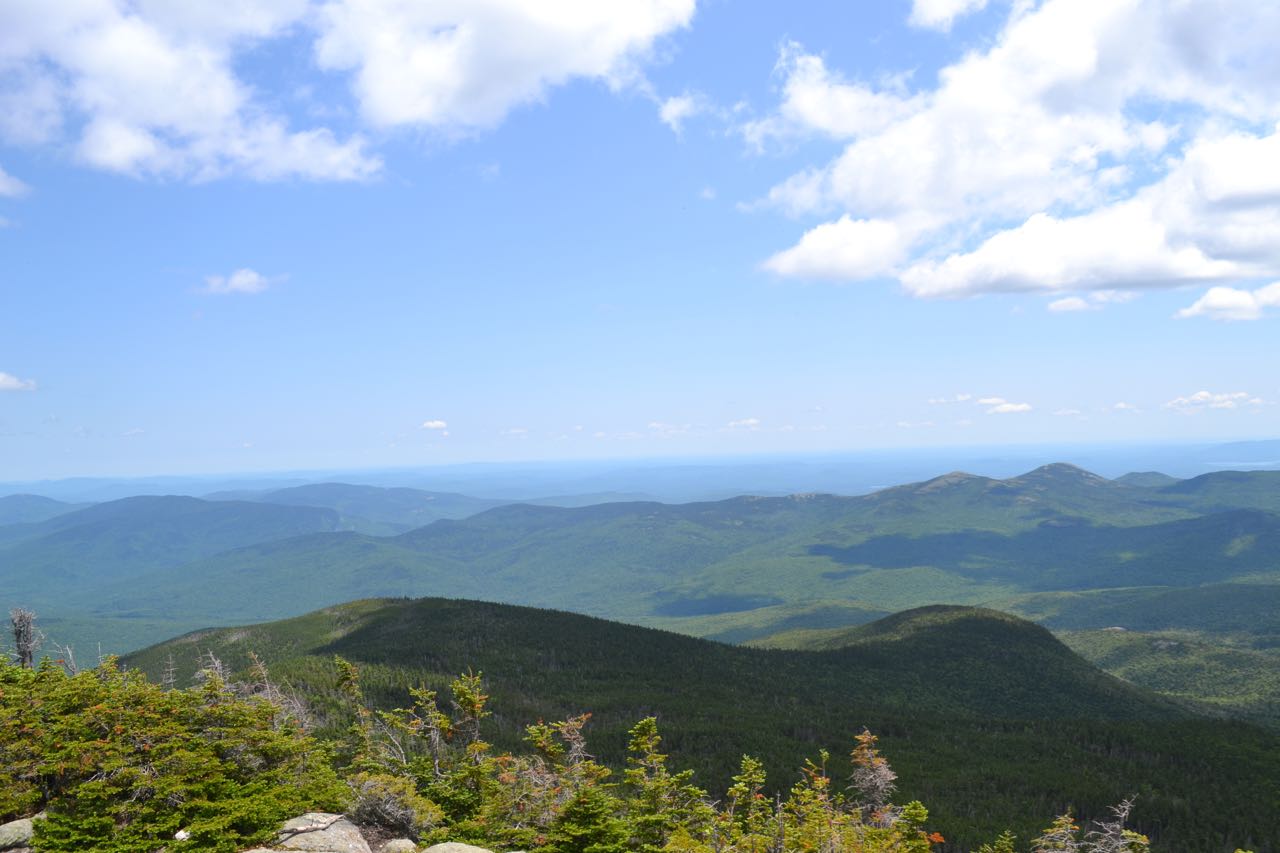
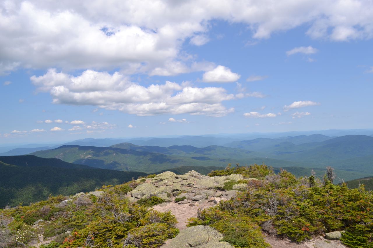
Mt. Hight's summit provides hikers with spectacular views in all directions, including a great look across the notch at the lofty Northern Presidentials, views north and south along the Carter-Moriah Range (which Mt. Hight is a part of), and an expansive vista over the Wild River Wilderness. To the southwest rises nearby Carter Dome. To the right, far in the distance, is Mt. Hancock, with Wildcat Mountain below and next to Carter Dome. To the west are the Presidentials: Boott Spur, Mt. Washington, Mt. Jefferson, Mt. Adams, and Mt. Madison. The Great Gulf opens up below Mt. Adams. To the northwest are the Pliny and Pilot Ranges, with the Crescent Range below. To the north along the range are South and Middle Carter Mountains, with many distant mountains in the Great North Woods, Maine, and Canada above. Off to the right of Middle Carter and far below are the ledge-spotted Mt. Moriah and Shelburne Moriah, with the Mahoosuc Range beyond. To the northeast are the distant high peaks of Maine, and just further over are the mountains around Evans Notch: Caribou Mountain, Royce Mountain, and Speckled Mountain. To the east is the Baldface Range, from low Mt. Meader up to the two rounded domes of the Baldfaces. Next over from South Baldface is Eastman Mountain, which peeks out from the col between South Baldface and Sable Mountain. Above is the long ridge of Maine's Pleasant Mountain. To the right of Sable Mountain is Chandler Mountain. To the southeast are the lower hills centered around the distinctive Kearsarge North. Doublehead Mountain is in front, with Black Mountain even closer. To the south is Moat Mountain, with the Ossipee Range behind and the eastern Sandwich Range, including Mts. Chocorua and Paugus. The rest of the Sandwich Range is hidden behind Carter Dome.
Printable directions page